
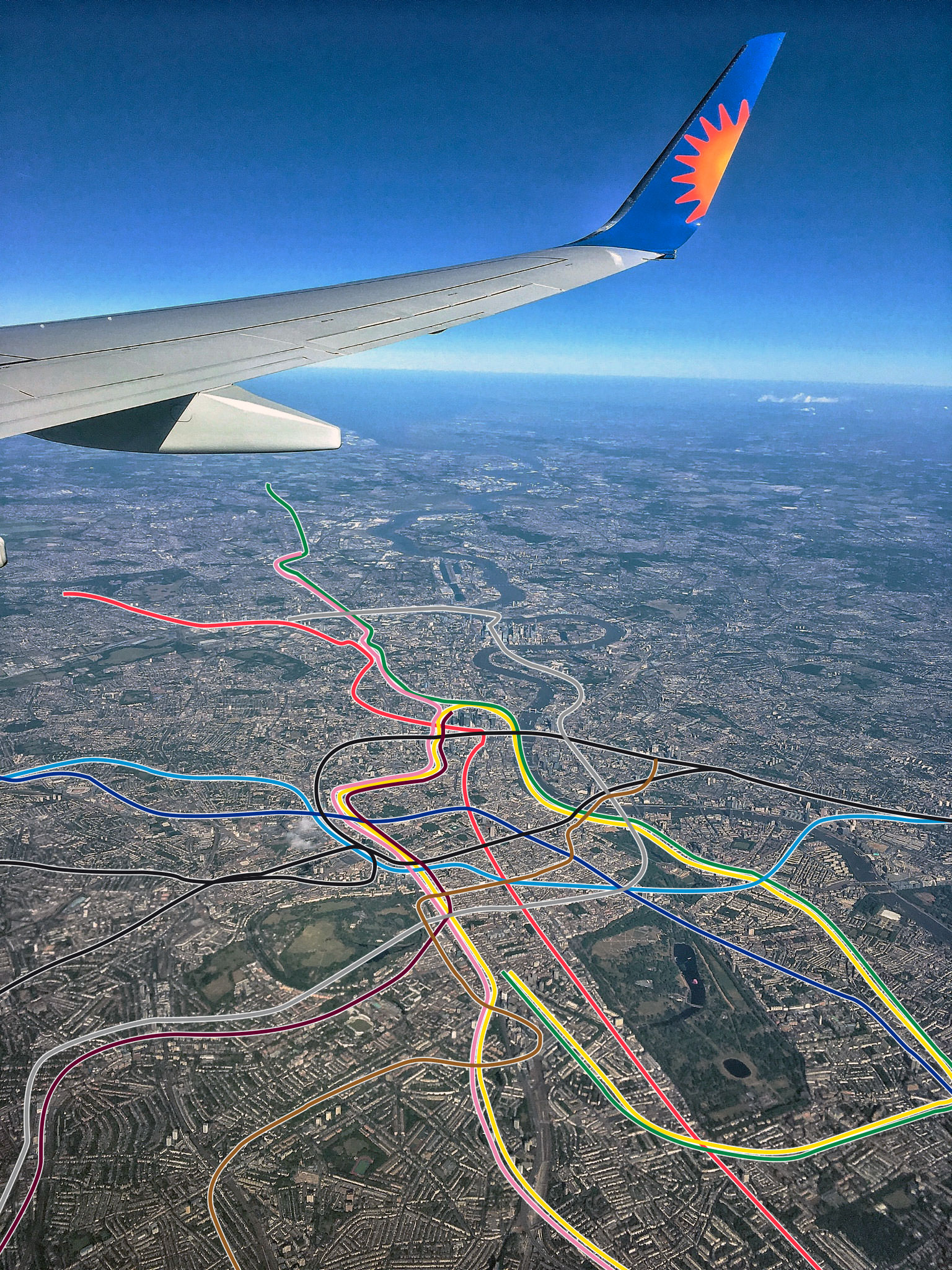
This has made the rounds on social media and I thought it was worth sharing with all of you. I don’t know how accurate it is. But it’s pretty freaking cool. A Reddit user has overlaid the path of the various Tube lines in London on an aerial picture. It shows the spaghetti-like tendrils of London’s transport network as they weave their way in the geography of London. Very cool. Gives context to the straight and curvy lines of the Tube map to see how they really relate to London.
Color coding for those unfamiliar:
- Green = District Line
- Red = Central Line
- Pink = Metropolitan Line
- Grey = Jubilee Line
- Yellow = Circle Line
- Black = Northern Line
- Dark Blue = Piccadilly Line
- Light Blue = Victoria Line
- Brown = Bakerloo Line
Source: Reddit.
Author: jonathan
Jonathan is a consummate Anglophile who launched Anglotopia.net in 2007 to channel his passion for Britain. Londontopia is its sister publication dedicated to everything London.
Is that Map available for sale?
No.
Would be better with some landmark tags. And also looking directly down rather than at an angle. Given this version 5 out of 10.