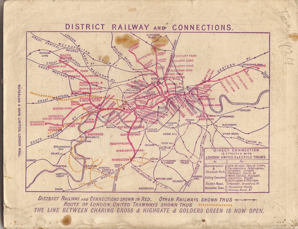
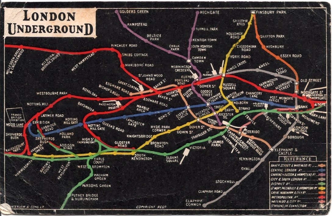
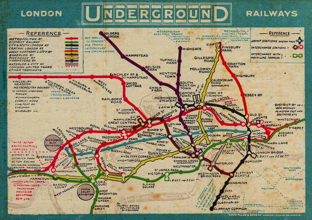
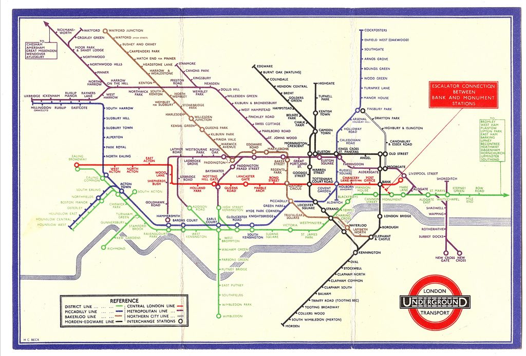
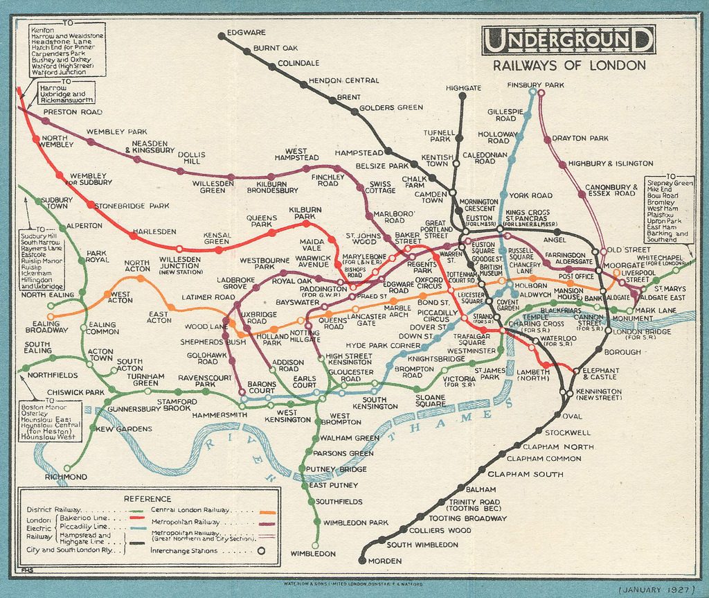
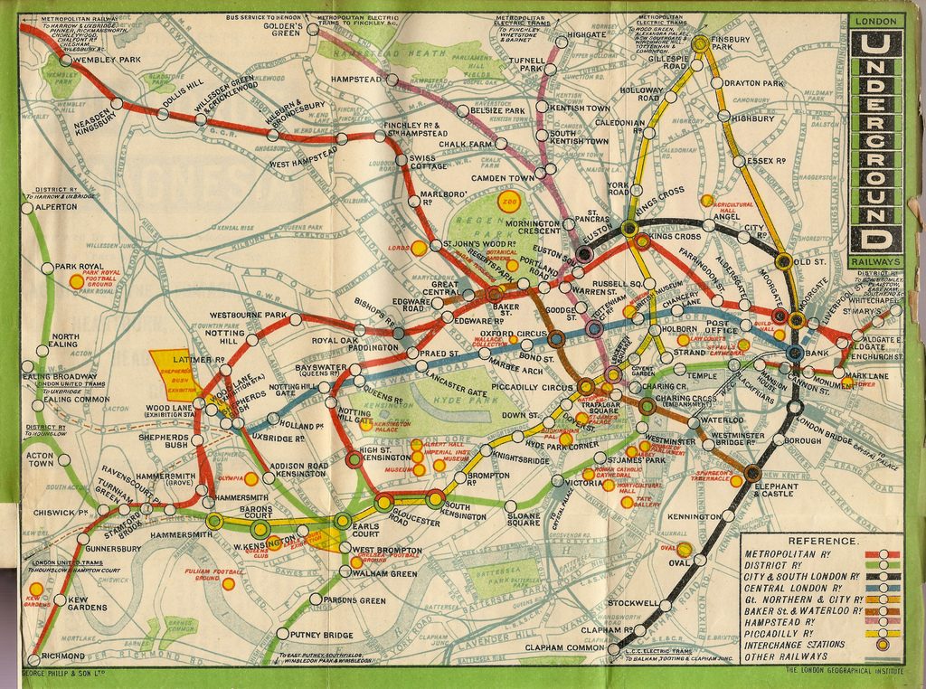
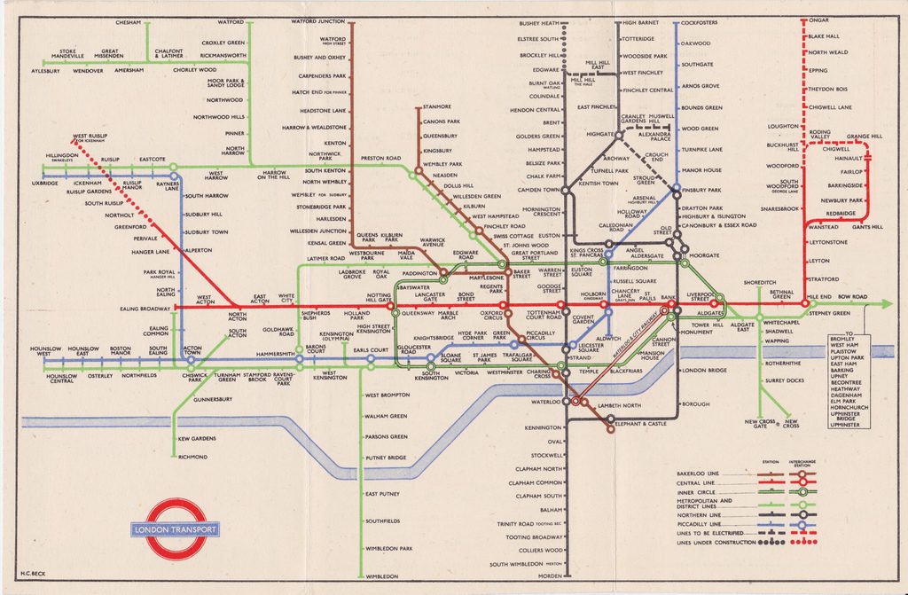
Check out this really cool selection of Old London Tube Maps, some dating from before the iconic Beck map came into use.

Free London Weekly Newsletter
A Little Bit of London In Your Inbox Weekly. Sign-up for our free weekly London newsletter. Sent every Friday with the latest news from London!
I have my own collection on an up-to-date blog I created over 3 years ago showing over 300 maps from 1863 to 2014.The blog is in French because a book was published under Capital Transport Publishing Co titled “No need to ask” which already show a wide variety of maps. But I noticed there are some French enthusiasts about railwayana and transport maps so I decided to make it in French (can be translated easily with the Google Translation tools directly onto the blog page). The link is : http://histoiredesplansdemetrodelondres.blogspot.ca/ You have to scroll all pages one after another by clicking on “Articles plus anciens” (Older articles) on the bottom page. Enjoy!
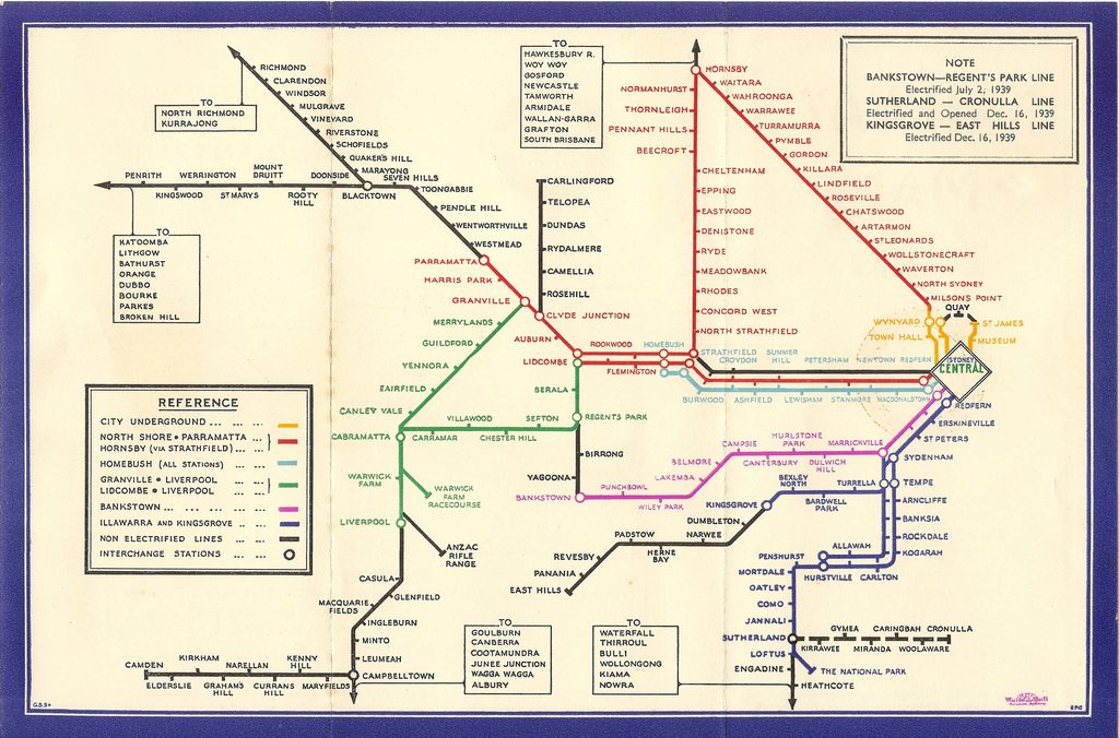
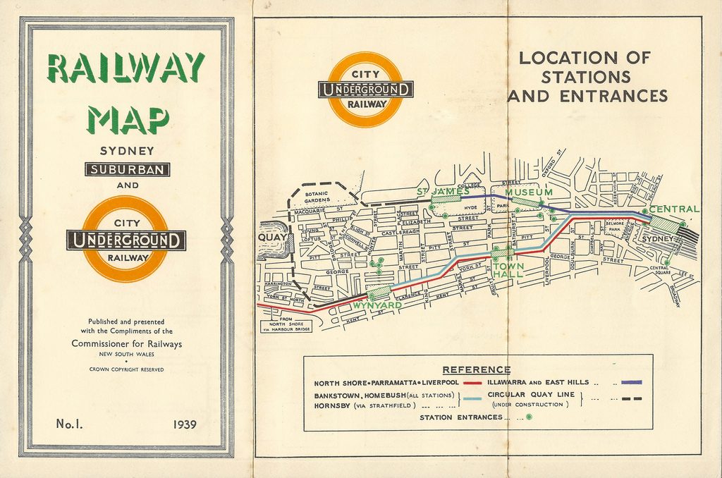
To alleviate any confusion, the last map is actually for Sydney, NSW, Australia. But it was printed in 1939, so it is old ?