


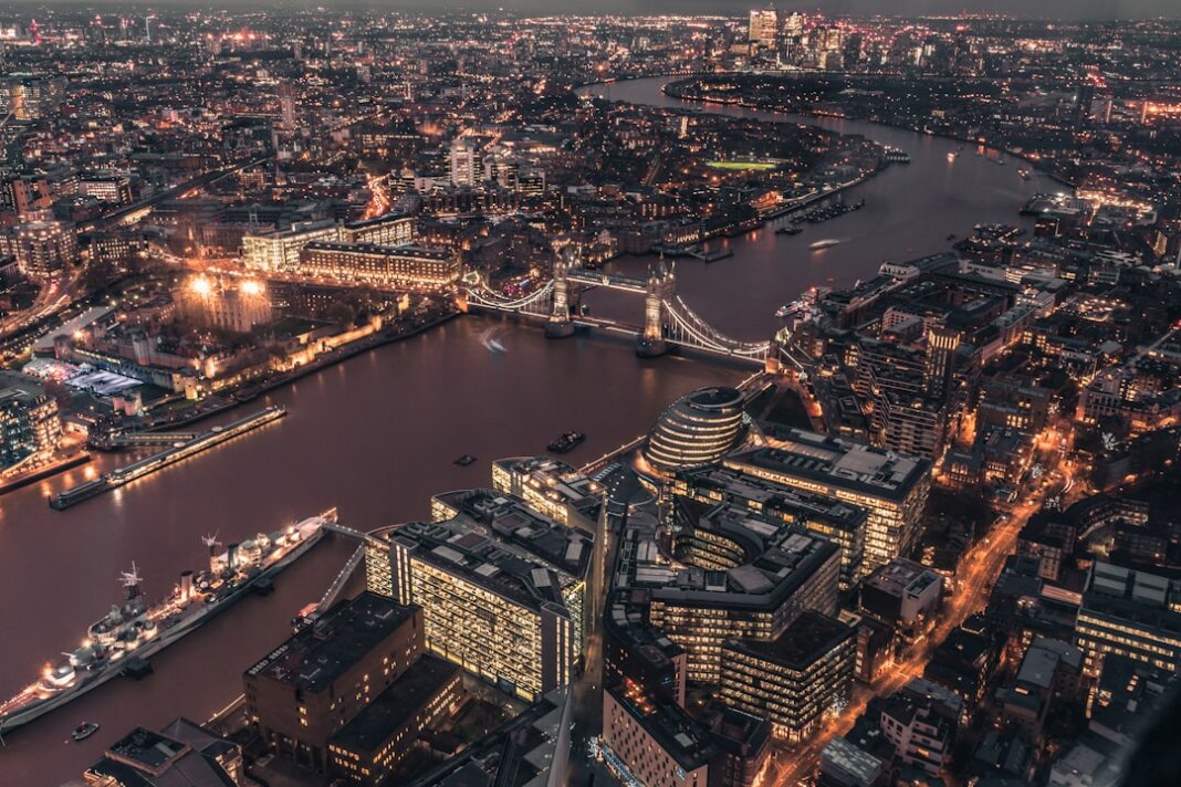
London is a river city, but if you spend time walking its streets, you might be forgiven for forgetting that fact. Yes, the Thames dominates the landscape, but there’s a hidden network of rivers flowing beneath the city, diverted underground and built over, but still present, still flowing, still shaping the geography and history of London in ways that are visible if you know where to look. These are London’s lost rivers, and their story is one of ecological change, urban development, and the way that human ambition constantly rewrites the landscape, even as the underlying geology and hydrology quietly insist on their own patterns.
The lost rivers of London aren’t actually lost—they’re just hidden. They flow beneath the city, channelled into culverts and pipes, their courses determined by medieval street patterns and Victorian engineering rather than natural topography. But if you understand their routes, you can trace them through modern London, spotting clues in street names, in the sudden dips and rises of the street surface, in the location of bridges, and in the curious geography of neighborhoods. Understanding London’s lost rivers is understanding the layer beneath the city that most people never notice—the water that shaped settlement patterns, that determined where markets would be located, where mills would be built, where industry would concentrate.
The Fleet River: London’s Most Significant Lost Waterway
Of all the lost rivers of London, the Fleet is the most historically significant and the most thoroughly documented. The Fleet once flowed from the springs on the slopes of Hampstead Heath, wound through North London, crossed the area that would become central London, and joined the Thames near Blackfriars—hence the bridge that still bears the name of this long-gone river connection.
The Fleet was a substantial river, not some insignificant stream. In medieval times, it was important enough to have its own bridges, its own network of mills, and to serve as a boundary marker for different areas of the city. Fleet Street, one of London’s most famous thoroughfares, runs parallel to where the Fleet once flowed openly. The connection between the street and the river tells you something important: streets were often built along rivers because rivers were important routes for transport and commerce. As London developed, the street outlasted the river—or rather, the street took over, and the river was forced underground.
The Fleet began to be culverted (covered over and channelled through pipes) in the 18th century, a process that was completed by the 19th century. The reasons for this were partly practical—London’s growing population produced increasingly large amounts of waste, and the Fleet, like all of London’s surface rivers, became an open sewer. The smell and the disease were appalling. By the Victorian era, covering rivers and channelling them through underground pipes seemed like a rational solution to an urban sanitation problem. The Fleet was diverted into the London sewerage system, and it disappeared from view.
But you can still trace its course if you know what to look for. The river began in the springs near Hampstead Heath, and you can still find evidence of those springs in the names of places—Hampstead itself derives from “homestead,” and the settlement developed around the fresh water source. The river flowed south, and now its course is roughly followed by Hampstead Road, which is a significant thoroughfare in North London. The street runs downhill along the natural topography that the river shaped, and if you walk along it, you can feel the landscape tilting downward in the direction the water once flowed.
As the river moved south through London, it passed through the area that would become King’s Cross and St Pancras, important areas of Victorian London. The proximity to the river (and later, the presence of the underground watercourse) influenced the development of the area. Factories and mills were built along the river, taking advantage of water power and water transport. The building of the great Victorian railway stations in this area suggests that the hidden river still influenced urban development even after it had been culverted.
The Fleet continued south, crossing the area where King’s Cross Station now stands, and then through what is now Bloomsbury. A number of streets in the area follow the course of the buried river—Ray Street, Farringdon Road, and Farringdon Street all run roughly parallel to or directly over the culverted watercourse. Farringdon Road actually has a section that was deliberately left open as a channel for the Fleet, visible from the street, a deliberate decision to allow some visibility of this hidden river.
The river reached the Thames near Blackfriars, and at the point where it met the larger river, there was once a substantial tidal flat where the Fresh Water ran into the salt water of the Thames. This landscape of meeting waters shaped the medieval city’s development. The Blackfriars monastery, which gave its name to the area, was located on the banks of the joining rivers, and the landscape and water were central to the monastery’s choice of location.
The Walbrook: The Roman River
The Walbrook is another of London’s major lost rivers, and its history extends back much further than the Fleet’s. The Walbrook was important to Roman London—Londinium, as the Romans called it. The river ran from the area now known as Finsbury, in North London, down through the City, and into the Thames at the point where the City’s Roman settlement was concentrated.
The name “Walbrook” is somewhat mysterious, possibly deriving from “wealh” (foreign) or “weald” (forest), or possibly from a corruption of “wall brook,” a reference to walls along the river. Whatever its etymology, the Walbrook was significant enough to have Roman settlement focused around it. Archaeological evidence shows that there was a Roman temple dedicated to Mithras on the banks of the Walbrook, discovered during post-Second World War rebuilding and the reconstructed temple is now displayed at the London Mithraeum (Bloomberg SPACE) on its original site.
The Walbrook followed a course that roughly corresponds to the modern street called Walbrook, which runs through the City in a curved path. The river provided fresh water and was a natural gathering place for settlement. It was important enough to Romans that water management infrastructure was built around it—the Romans were excellent engineers, and they understood the importance of water.
As London developed through the medieval period, the Walbrook remained visible and functional, though it gradually became polluted by the city’s waste, just like the Fleet. By the medieval period, there are records of complaints about the state of the Walbrook, the smell, the waste dumped in it, and the disease it harbored. Like the Fleet, the Walbrook was eventually culverted and disappeared beneath the streets, but you can still trace its course through the City by following Walbrook Street and noting how the street curves in ways that don’t correspond to the modern city plan but do correspond to the original river’s path.
The Tyburn: The River of Execution and Commerce
The Tyburn is another of London’s lost rivers, and it has a particularly dark historical association. The name “Tyburn” comes from “Ty” (two) and “burna” (stream), reflecting the fact that the river had two main branches. The river flowed from the area now known as Swiss Cottage in Hampstead, down through what is now central London, and into the Thames near present-day Westminster.
The Tyburn is historically significant as the location of the Tyburn gallows, a gruesome public execution site that operated from medieval times through the 18th century. The gallows were located near present-day Marble Arch, where the river ran. Public executions were significant ritual occasions in medieval and early modern London, and the location near water might have been chosen both for practical reasons (water for the crowds, natural gathering place) and symbolic reasons (purification, the threshold between the city and the countryside).
Beyond its association with executions, the Tyburn was an important source of fresh water for medieval London, and mills and other water-powered industries were located along its course. The river followed a route that roughly corresponds to modern Piccadilly, Park Lane, and Oxford Street—surprising as it might seem to imagine a river flowing along London’s busiest shopping streets, but that’s exactly what happened.
Like the other lost rivers, the Tyburn was progressively culverted and diverted into the sewerage system as London grew and the river became increasingly polluted. But you can still trace its course if you know to look for it. The slight depression of some streets follows the river’s course. Place names preserve the memory—Tyburn Street, various bridges with “Tyburn” in the name—and if you walk along the supposed route of the river, you start to notice how the topography makes sense in relation to water flow.
The Westbourne: The Elegant West London River
The Westbourne is yet another of London’s rivers, and it has a particularly interesting story because portions of it remain visible in modern London. The Westbourne flowed from springs in the area now known as Hampstead, flowed south through West London, and emptied into the Thames at Chelsea.
What makes the Westbourne particularly distinctive is that it was diverted and channelled through what is now the Serpentine Lake in Hyde Park in the 18th century. The Serpentine is an artificial lake created for recreation and beauty, but it’s actually fed by the Westbourne, which flows beneath it. The river was further diverted through Green Park and St James’s Park as part of the same project. The careful engineering of these 18th-century gardens and parks was partly about creating beauty and partly about managing the water that the lost river still provided.
The Westbourne then continues underground south of the parks, passing beneath Knightsbridge and other fashionable West London areas, before finally reaching the Thames at Chelsea. One of the most fascinating features of the Westbourne’s course is that it passes beneath the railway viaduct at Sloane Square in Chelsea. Commuters on the London Underground actually pass directly above the Westbourne river as they travel through Chelsea station, though most of them are completely unaware of the river flowing beneath their feet.
The Westbourne had considerable significance in medieval times, partly because it provided fresh water and partly because it had mills along its course. The establishment of convents and religious houses near the river is evidence of the importance of fresh water—religious communities needed clean water for drinking, cooking, and ritual purposes. The geography of medieval West London was significantly shaped by the Westbourne’s presence.
The Other Lost Rivers
Beyond these major rivers, London had several other significant watercourses that have been culverted and hidden. The Cray, the Ravensbourne, the Neckinger (possibly named after a noose, continuing the theme of the Tyburn’s dark associations), the Quaggy—these were all rivers that shaped medieval and post-medieval London’s development. Some of them still flow to the Thames, though most of their course is now underground.
Each of these rivers had its own significance to the communities that developed near them. They provided fresh water, power for mills, routes for transport and trade, and natural gathering places for settlement. The persistence of these rivers even after culverting and diversion—the way they still flow beneath the city, still shape the topography and the underground landscape—speaks to the way that natural forces continue to exert their influence even when humans have attempted to completely control or dominate them.
How to Spot London’s Lost Rivers
If you want to become a detective of London’s hidden rivers, there are several signs to look for. Street names are the most obvious clue—streets named after rivers (Fleet Street, Walbrook Street, etc.) almost always mark the course of an underground watercourse. Sometimes the names are more obscure: Turnmill Street, for instance, refers to a mill on the Turne, another lost river.
The topography of the city itself is a clue. If you pay attention to gradients and the way the city slopes, you can trace the natural flow of water. Rivers create valleys, and even when they’re hidden, the valleys remain. Bridges are another clue—there are numerous bridges and footbridges in London that cross hidden rivers. Medieval bridges survive in place names even when the physical structure is long gone. Some streets have curious undulations or humped surfaces where they cross the culverted watercourse.
Wet basement problems in old buildings are another clue. Despite the culverts, the water still wants to flow, and during periods of heavy rain, the underground rivers can flood or seep into basements and building foundations. Building damage and repairs following flooding are often evidence of the presence of a hidden river.
Underground and historical maps show the courses of these rivers, and examining how they’ve been diverted and culverted can be genuinely fascinating. The Victorian maps, in particular, show the moment of transformation from surface rivers to hidden culverts.
The Ecological and Cultural Significance
The loss of London’s rivers represents a significant ecological change. The rivers were once habitat for fish, otters, and waterbirds. They were central to London’s ecology and the web of relationships between the city and the natural world. The culverting and diversion of these rivers broke those connections and contributed to the depletion of London’s ecological richness.
In recent years, there’s been increasing interest in “daylighting” some of London’s lost rivers—uncovering them, allowing them to flow openly, and restoring their ecological and recreational value. Some sections of some rivers have been uncovered, and the response has been enthusiastically positive. These restored river sections become not just ecological assets but also beloved public spaces, places where Londoners can connect with the natural world and the history of their city.
The lost rivers also have cultural and historical significance. They’re part of the story of how London developed, how medieval settlement patterns were determined, how the city adapted to urban growth and the management of waste. Understanding the lost rivers is understanding the substrate upon which modern London was built. It’s recognizing that the city is not simply a human creation imposed on a blank landscape, but rather a complex negotiation between human ambition and natural topography, between the desire for control and the persistent force of water seeking its own level.
Walking the streets of London and trying to trace the lost rivers is a way of reading the city with deeper comprehension, of understanding the hidden architecture that underlies the visible one. It’s a reminder that beneath the modern metropolis is an older London, a London shaped by water and geography, by medieval settlement patterns and Roman occupation, by the slow process of urbanisation and the gradual transformation from open rivers to hidden culverts. The rivers are still there, still flowing, still shaping the city even if most people never notice them. And in noticing them, in tracing their courses and understanding their significance, you gain a richer and more complete understanding of London itself.


Free London Weekly Newsletter
A Little Bit of London In Your Inbox Weekly. Sign-up for our free weekly London newsletter. Sent every Friday with the latest news from London!